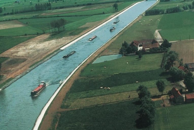
Belgium consists of three main geographical regions: a flat and low lying plain near the North Sea, central Belgium, where the plain alternates with low hills, and the higher Ardennes in the south and east.
The lowland consists of a narrow swamp area protected by dikes, the polder land. Polderlandet is an average of about 12 km wide, and turns into sand letters that include Flanders and Kempenland. The northern part of Flanders consists of fine-grained sand, the southern one of a more fertile mixture of sand and clay deposited in the Tertiary and Quaternary times. Kempenland is a wide sandy plain, and unlike Flanders sparsely populated. Large areas are planted with forest, mostly coniferous forest.
Central Belgium includes plateaus such as Hainaut in the west and Haspengouw (French Hesbaye ) in the east which include parts of the provinces of Liège, Limburg, Brabant and Namur. These plateaus have altitudes of between 50 and 300 meters, and are made up of tertiary clay and sand layers, to the south also of limestone.
In the south-east of Belgium lies the Ardennes, which are part of the Rhine slate mountains. They consist of heavily folded Devonian, in the north also carbonate slate, sandstone and limestone. The height is an average of 300–600 meters above sea level, the highest point being Botrange (692 meters above sea level) in Hohe’s Friend (French Hauges Fagnes, Dutchman, Hoge Venen). The area is divided by steep, deep valleys, with a slope to the north towards the Meuse Valley. The Ardennes are cut from the south to the north by Meuse, which swings east at Namur, where it joins Sambre coming from the west.
Flanders. Lowland plain on the river Schelde in Belgium. Flanders is a fertile agricultural area, known for its cultivation of flax.
Climate
Belgium has a temperate coastal climate, dominated by maritime air masses from the west. Winters are generally over mild, summers cool. The climate shows relatively small regional variations, although there is a noticeable difference between the cool and rainy Ardennes and the warmer and drier Flanders.
The average temperature in January is 2.5 °C in Ostend on the North Sea coast, 1.5 °C in Uccle (Uccle) in Brussels and 0 °C in Bastogne in the Ardennes. Corresponding figures for July are 17 ° C in Ostend and Ukkle, 15 °C in Bastogne. The annual rainfall varies from 1000 mm in Bastogne, to 850 mm in Ukkle and 600 mm in Ostend.
Plant and wildlife in Belgium
Belgium has little of the original vegetation, and most of the area is cultivated. Forest covers approx. 20% of the country’s area, of which most (70%) is in the Ardennes. Beech is the dominant tree species, but oak and bark beetle are also widespread.
The mammalian fauna includes hedgehogs, squirrels, southern hares, rabbits and hazel mice. Of the predators should be mentioned reefs, wild cats, badgers, housewives, roe and mink. Deer and deer are common, deer and wild boar occur in smaller numbers in the eastern forest.
Numerous migratory birds rest or overwinter at the outlet of the rivers Yser and Zwin; tundra, semen and short-billed geese, ducks and waders. In the woods, meadows and swamps in the north nest among other things, night troughs, black-spotted, blue-throated, pipe-drum and big spurs.
