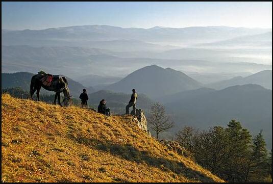
There are eight different climatic and vegetation zones in a very small space, which have produced a multitude of cultural landscapes.
The Black Sea coast has a subtropical, humid and warm climate. Here – in the zone of tea, citrus fruits and a formerly flourishing tourism – are (from north to south) – Abkhazia, Mingrelia, Guria and Adjara.
Further inland are the Svaneti, Rashta and Letschchumi mountain landscapes – famous for their fortified villages and the art of singing. From this south one comes to the west Georgian heartland of Imeretia with Kutaisi as the center.
East of the Lichi Mountains is the central depression of Eastern Georgia – the Kartli region, characterized by dry summers and cold winters.
South of Kartli, the Lesser Caucasus rises with the regions of Mes’cheti and Javakheti, heavily populated by Armenians (2002 census over 50%) and Turkic-speaking Mes’kheti who have returned from deportation.
In the far east – in the border area with Azerbaijan – you finally come to the wine-growing area Kakheti.
To the north of it, in the rugged Greater Caucasus, lie valley communities with their own traditions: Chewsureti, Chewi, Tusheti, Pschawi and Mtiuleti.
According to a2zgov, Georgia has a high level of biodiversity thanks to different climatic zones. Enclosed valleys favored the development of endemic plants and animal species that are only native to this region. The WWF ranks Georgia among the 238 most important ecoregions in the world. The IUCN (International Union for the Conservation of Nature and Natural Resources) has named Georgia as a global center of plant diversity and BirdLife International has designated BirdLife International as a worldwide endemic bird area.
Mountains: Shchara / (5,193 m), Djanga / Dzhangitau (5,058 m), Kasbek / Mqinvartsveri (5,047 m).
Rivers: Mtkvari (Kura) – 1,515 km (including 351 in Georgia), Alazani 407 km (including 390 in Georgia).
Lakes: Parawani (38 sq km, 3.3 m deep, located at 2,073 m), Tabatskuri (14 sq km, 40 m deep, 2,000 m high), Keli (1.3 sq km, 63 m deep, located at 2,900 m altitude), Ritsa (1.5 square kilometers, 101 m deep, 880 m high).
Climate: The different climate zones range from a subtropical, humid climate in the west to a dry and moderate continental climate in the east. The average air temperature fluctuates between 15 °C in the west and 11 to 13 °C in the east. The average rainfall in the west is 3,000 mm, in the east 400 mm. Spring in Georgia is short with abrupt climatic fluctuations, and summer is often hot. Autumn is warm and sunny, winter with little snow. Weather forecasts for the capital and other cities are always available via the Internet.
Natural resources: forest (approx. 3 million ha), hydropower, “niche products” such as nuts, rose oil, medicinal herbs; the subtropical climate on the Black Sea enables the cultivation of citrus fruits and tea (in total only 11.51% UAA, 3.79% arable land, but 55.6% of the workforce live from agriculture!); approx. 450 sites of 27 different mineral resources, including high-quality manganese ore (ChiaturiaReserves – 200 million t, annual production up to 6 million t), hard coal (Tkibuli, reserves – 400 million t), copper ores (Marneuli – 250 t), crude oil (Samgori, Patardzeuli, reserves approx. 30 million t); Building raw materials; approx. two thousand water sources, including medicinal springs with approx. 40 billion liters per year. The German Federal Ministry for Economic Affairs and Energy carried out a study on renewable energies in Georgia in 2015, the report can be viewed here. At the same time, the WWF repeatedly refers to the dangers of overexploitation of natural raw materials for the biodiversity of the region.
Ecological problems & nature and environmental protection
Georgia is one of the areas with the greatest biodiversity in Europe. On the other hand, there are numerous problems of nature and environmental protection that have not yet been adequately solved. One of the first state committees for nature conservation was established in Georgia as early as 1974, and in 1991 a ministry for environmental protection and natural resources took over its tasks. In 2011 it was renamed the Ministry of Environmental Protection. 15 international conventions for the protection of the environment and nature have been signed and ratified so far, seven are still pending.
Although air and water pollution has been reduced in recent years, the problem areas around the ironworks town of Rustavi, the pollution of Kura and the Black Sea, the contamination of soils with toxic chemicals, such as waste disposal and water management, are tasks that need to be solved. Work is also underway on land use plans that separate the protected nature from agricultural and industrial areas. Problems of deforestation and overgrazing are mentioned as problems, but in the last seven years the area of the 17 protected areas has increased from 4.2% to 13.5% of the state territory. However, there are other designated protected areas under occupation.
The largest of 9 national parks is Bordshomi-Kharagauli (85,000 hectares). It was opened in 2001 with German help and support from WWF and is also considered a tourist destination. It is one of the largest contiguous nature reserves in Asia. The Tusheti National Park covers 83,007 hectares, the Vashlovani National Park 25,112 hectares and the Tusheti Protected Area 27,903 hectares. The oldest national park in Georgia is the Lagodechi National Park (1912) with 17,688 hectares. Environmental and nature conservation are an important focus of the German government’s Caucasus Initiative, which primarily supports cross-border projects. On behalf of BMZ, GIZ supports the Georgian government with integrated biodiversity management in the South Caucasus. In the past few years, NABU Germany has encouraged entrepreneurial activities in Georgia that should be in harmony with nature and environmental protection. The WWF finances, among other things, monitoring programs and supports NGO work in environmental and nature conservation.